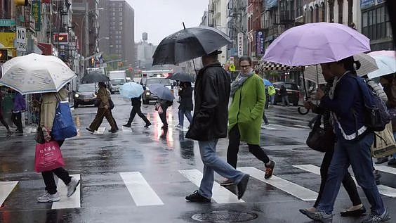
New York City and the surrounding tri-state area are bracing for a weekend of severe weather, with temperatures expected to soar into the 90s along with the threat of strong thunderstorms looming. The National Weather Service has issued a Red Alert for Sunday, warning of “strong to severe” thunderstorms, particularly in the late afternoon and evening.
The primary threat from these storms is damaging winds. AccuWeather predicts showers between 2 pm and 10 pm, which could lead to flash flooding and localized damaging wind gusts. There is also a rare possibility of tornadoes due to the powerful winds associated with these storms.
A Heat Advisory has been issued for Somerset, Middlesex, Monmouth, and Ocean Counties from 11 am to 7 pm on Sunday. With high humidity, heat indices could reach the upper 90s to low 100s, especially in central and southern New Jersey.

For all south-facing beaches in New York, there is a high risk of rip currents, throughout the weekend. Beachgoers are advised to exercise caution and stay informed of local conditions.
Saturday night forecast
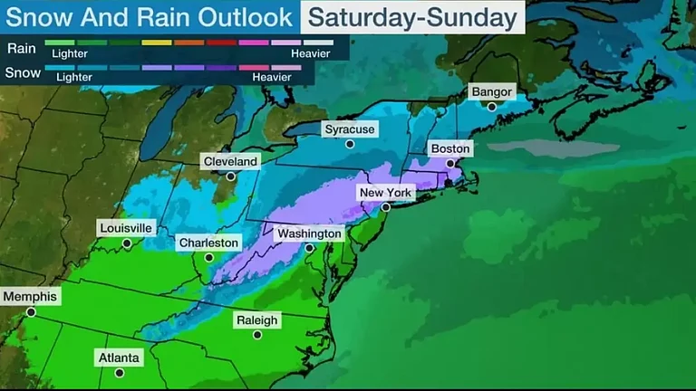
A Yellow Alert has been issued for Saturday night, as a potent line of thunderstorms is moving toward the area from Pennsylvania. These storms, which have already triggered tornado warnings in Pennsylvania, could bring heavy rain and gusty winds to the tri-state area. Isolated severe storms are possible, with additional renegade storms potentially moving through the region overnight. Temperatures will remain in the 70s, with very muggy conditions.


Sunday forecast
Sunday could see isolated storms in the morning before some sunshine breaks out, leading to temperatures in the upper 80s and low 90s. The combination of heat and humidity will prime the atmosphere for the development of strong to severe storms in the afternoon and evening. These storms may bring damaging winds, hail, torrential downpours, and the possibility of isolated tornadoes. Rainfall totals could reach 2-3 inches in some locations, raising the risk of flash flooding.
Impact on tri-states
In New York, more than 2,500 residents were still without power as of Saturday afternoon following intense thunderstorms earlier in the week.
Nearly the entire state faces a risk of flash flooding on Sunday in New Jersey, though the risk is labeled “low.” Over 2,100 residents were still without electricity on Saturday.
Temperatures are expected to be hot and humid in Connecticut, reaching the low 90s on Sunday. The state faces a level 2 out of 5 risk of severe weather. More than 1,000 residents were without power as of Saturday evening.

Temperatures in the tri-state area are expected to remain in the 80s next week, with clear skies anticipated until more rainfall the following weekend.
Residents are urged to stay informed through local weather updates and take necessary precautions to stay safe during the severe weather events.

.png?auto=format%2Ccompress&fit=max&format=webp&w=376&dpr=2.0)