A severe thunderstorm warning has been issued for Newton, Jasper, Lake, and Porter counties in Indiana until 1:15 am as powerful storms make their way through the region. Residents are advised to stay indoors and monitor weather updates.
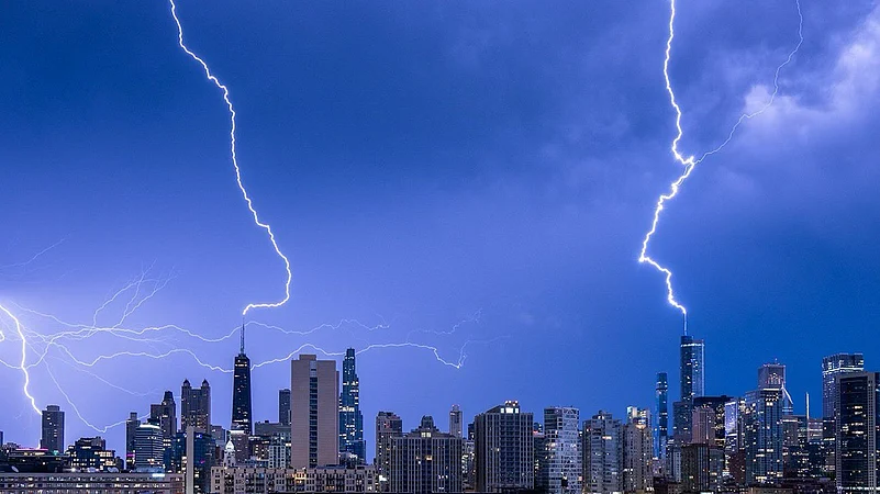
Late Sunday night, a tornado warning was briefly in effect for downtown Chicago and other central areas as dangerous storms swept through, toppling trees and causing flooding. The warning, initially set to run until 11 pm, was lifted by 10:50 pm. Affected areas included Old Town, Lawndale, Bridgeport, Back of the Yards, the South Loop, and Bronzeville.

While no confirmed tornadoes were reported in Chicago, the storm's rotation signature was strong enough to prompt the warning. The storm caused significant wind damage.
On the Southwest Side, cars were submerged in water on the Stevenson Expressway at Pulaski Road.
Earlier in the evening, law enforcement reported a likely tornado on the ground just after 9:30 pm near Elburn, northwest of Chicago. A funnel cloud was also sighted on the Jane Addams Memorial Tollway near the Belvidere Oasis.
A tornado warning was issued after midnight for LaSalle and Livingston counties but was lifted by 12:30 am
Severe thunderstorm warnings were issued county by county as the storm system progressed. By 11:25 pm, the severe weather had moved out of Chicago, but warnings remained in effect for Northwest Indiana and counties south and southwest of the city.


The storm system brought 60 mph wind gusts and pea-sized hail earlier in the evening.
A flash flood warning is in effect until 1:30 am for southeastern Cook, southern DuPage, and northwestern Will counties. A flood watch remains in effect until 4 am Monday. Parts of northern Illinois experienced widespread flash flooding on Saturday night, and additional heavy rain is expected to cause rapid water rises and potential renewed significant flash flooding.
Monday's weather is forecasted to be hot and stormy, especially late into the night. Dangerous heat will build throughout the day, with highs in the mid-90s and a heat index of 100 to 106 degrees. The Storm Prediction Center has elevated the area to a level 3 storm threat for Monday, indicating an even higher risk than anticipated for Sunday night.