Despite rain causing floods, severe waterlogging and even deaths in some parts of India, including Delhi where an intense spell of rainfall led to some casualties on Friday, Northwest India recorded its warmest June last month since 1901, the India Meteorological Department said on Monday.
Northwest India recorded a mean temperature of 31.73 degrees Celsius in June, 1.65 degrees Celsius above normal and the highest since 1901, news agency PTI quoted IMD chief Mrutyunjay Mohapatra as saying.
The monthly average maximum temperature in the region settled at 38.02 degrees Celsius, 1.96 degrees Celsius above normal. The average minimum temperature stood at 25.44 degrees Celsius, 1.35 degrees Celsius above normal, according to IMD data.
Torrential Rain In Delhi Not Due To Cloudburst: IMD
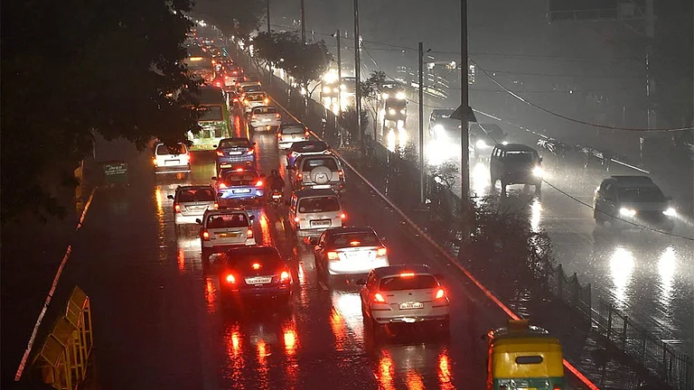
The torrential rain that brought Delhi to a standstill last Friday, June 28, was not a result of a cloudburst, but it was 'very close' to one, the IMD said on Monday.
IMD chief Mrutyunjay Mohapatra said the Safdarjung Observatory, the city's primary weather station, recorded 91 mm rainfall between 5 am and 6 am on June 28. Similarly, the Lodhi Road weather station logged 64 mm from 5 am to 6 am and 89 mm from 6 am to 7 am.
"These do not warrant to be declared as cloudbursts, but it was very close to a cloudburst," Mohapatra said.

Why Did Delhi Receive Unprecedented Rain On June 28
Explaining the reason behind the extreme rainfall in Delhi on June 28, the IMD had earlier said multiple large-scale monsoonal weather systems created conditions for mesoscale convective activity over Delhi NCR, resulting in intense thunderstorms and heavy rainfall during the early hours that day.
This activity was supported by thermodynamic instability in the atmosphere, which is favourable for thunderstorms.
The Safdarjung Observatory recorded 228.1 mm of rainfall in the 24 hours ending at 8.30 am on Friday, more than three times the June rainfall average of 74.1 mm and the highest for the month in 88 years -- since 1936.
The IMD defines very heavy rain as rainfall amounting to between 124.5 and 244.4 mm in a day.
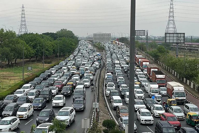
Heavy rain that started in the wee hours of Friday continued for hours in Delhi and adjoining areas of Noida, Ghaziabad and Gurugram, leading to severe waterlogging, massive traffic jams in several parts of the cities and a tragic roof-collapse incident at the Indira Gandhi International Airport (IGI) which killed one person and injured four others.
33% Rain Deficit In Northeast India
Northeast India recorded a 33 per cent rainfall deficit in June, which Mohapatra attributed to the sluggish advance of the monsoon over the northern and eastern parts of the country due to the lack of weather systems.
"Only one low-pressure area developed towards the end of June. Normally, we get three low-pressure systems. The Madden-Julian Oscillation was not favourable, and therefore, we could not get enhanced convection and low-pressure systems," Mohapatra said.
The absence of active western disturbances, mainly during the June 10 to June 19 period, was also a reason for the longer dry spell and heat wave prevailing over northwest and central India.
Mohapatra said only three western disturbances, against a normal of four to five, were observed across north India (June 5-10, June 19-25, and June 26-28).
Above Normal Rainfall Predicted For July
India could experience above-normal rainfall in July, except for parts of the northeastern region, the IMD said. IMD chief Mrutyunjay Mohapatra said July rainfall averaged over the country as a whole is most likely to be above normal -- more than 106 per cent of the long-period average of 28.04 cm.
"Normal to above-normal rainfall is most likely over most parts of the country except many parts of northeast India and some parts of northwest, east, and southeast peninsular India," he said.
The weather office said maximum temperatures are likely to be normal to below normal over many parts of northwest India and south peninsular India, except the west coast.
The minimum temperatures are most likely to be above normal over many parts of the country except some parts of northwest and the adjoining areas of central India, and some pockets of southeastern peninsular India, IMD said.