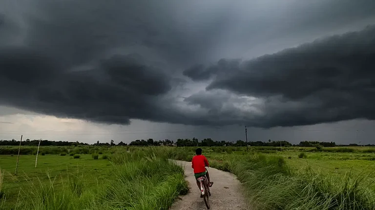
After surplus showers across large parts of India, the south-west monsoon retreat is finally underway, beginning from western Rajasthan and Kutch. Following the usual weather pattern, the southwest monsoon typically makes its onset over Kerala by June 1 and covers the entire country by the first week of July. The withdrawal from northwest India usually begins from the middle of September and ends by October 15.
However, due to certain changes in the climate scenario, this year's monsoon stayed a bit longer and the country received 880.8 mm rainfall between June 1 and September 23 against the normal of 837.7 mm for the period under review.

Monsoon retreat facts: Surplus rains, low-pressure belt
The process of monsoon retreat has brought five per cent excess rains across the country. However, the India Meteorological Department (IMD) predicted widespread rains in several regions over the coming week.
"Southwest monsoon has withdrawn from some parts of West Rajasthan and Kachchh on September 23, 2024 against the normal date of September 17. Conditions are favourable for further withdrawal of southwest monsoon from some more parts of West Rajasthan and adjoining areas of Punjab, Haryana and Gujarat during next 24 hours", IMD said.


While most of the country received normal to excess showers, nine of the 36 meteorological subdivisions have recorded excess rains, including Rajasthan (74 percent), Gujarat (68 percent), Maharashtra, Tamil Nadu and coastal Andhra Pradesh.
Five subdivisions experienced deficient rainfall including Jammu and Kashmir (26 percent), Himachal Pradesh (20 percent), Arunachal Pradesh (30 percent), Bihar (28 percent) and Punjab (27 percent).
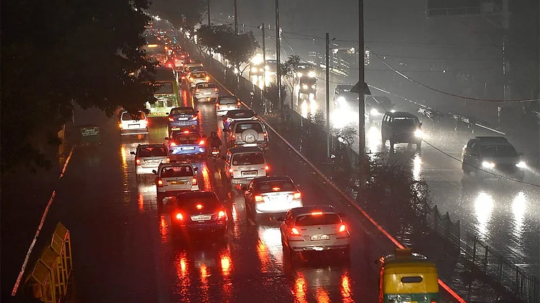
While the retreat process is underway, weather office has predicted formation of a low pressure area over west-central Bay of Bengal on Tuesday, which could bring rains to some states along the eastern coast.
Very heavy to extremely heavy rainfall is also likely to take place over coastal and north interior Karnataka, Maharashtra, Goa, central, east and northeast India during the coming week.

Extended monsoon: A shift in weather pattern
According to climate experts, the primary reason behind the extended monsoon is the slowed-down southwest monsoon onset and withdrawal leading to heavier-than-expected rainfall in northern and western parts of the country.
This year the arid and semi-arid regions of western states like Gujarat and Rajasthan have witnessed a shift from moderate monsoons to heavy and very heavy ones leading to extreme conditions like floods.
Experts point to climate change as the fundamental reason behind the unpredictable and intensifying monsoon patterns in India.
Changes in the ocean surface temperature towards the warmer direction temperatures are playing a pivotal role in bringing atmospheric changes and increasing moisture levels leading to catastrophic events triggered by heavier torrential downpours
.jpg?auto=format%2Ccompress&fit=max&format=webp&w=768&dpr=1.0)
Extended monsoon: Kharif crops impacted
From erratic rainfall leading to natural disasters to the damage to the crops- the extended prevalence of monsoon has thrown a huge challenge for the farmers as well as the governments as they are all concerned about the devastating consequences of prolonged rainfall.
With excess rainfall leading to excess rain-soaking by the fields, the harvested production is deeply affected leading to an increased risk of crop losses as the crops Kharif crops like paddy, maize, and cotton are highly sensitive to moisture levels.
However, despite problems in production due to excess rains, the sowing of kharif crops reached their best levels in recent years. According to the latest data from the government, kharif crops till September 20 were sown across approximately 110.46 million hectares, reflecting a 1.51 per cent increase compared to the same period last year, and 0.80 per cent above the normal acreage, defined as the average of the past five years (2018-19 to 2022-23). The standouts this season were paddy, arhar, groundnut, soybean, and maize.

Severe winter likely due to La Nina effects
Following an extended monsoon, the global weather watchdog World Meteorological Organisation (WMO) predicted a 'severe' winter for the Indian suncontinent this year owing to the 60 percent possibility of La Niña conditions towards the end of this year.
From scorching heatwaves during summer to extended monsoons, the weather patterns of the Indian subcontinent have been largely affected by the shifts in climate scenario. La Nina and El Nino, the intensity of the two opposite weather conditions are visibly increasing due to anthropogenic or man-made climate change events.

The El Nino and La Nina events
El Nino and La Nina, the opposite extremes in the El Niño/Southern Oscillation (ENSO) cycle, amplify the unpredictability of weather patterns. While El Niño causes weakened monsoons, La Nina leads to incessant rains and catastrophic floods.
El Niño, in simple words, is defined as a weather pattern involving abnormal warming of surface waters in the equatorial Pacific Ocean leading to extreme heat in many parts of the world and the ocean.
According to National Oceanic and Atmospheric Administration (NOAA), La Niña, on the other hand, demonstrates the opposite effect of El Niño. During La Niña events, trade winds are even stronger than usual, pushing more warm water toward Asia. Off the west coast of the Americas, upwelling increases, bringing cold, nutrient-rich water to the surface. These cold waters in the Pacific push the jet stream northward.