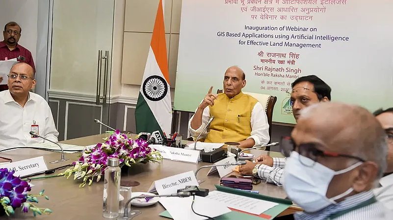
Defence Minister Rajnath Singh on Thursday urged state and central authorities concerned to realise the importance of having clear land titles to facilitate the setting up of new manufacturing hubs. In an address at an event, he said "foolproof management" of land parcels was important for India to become a global manufacturing hub.
"Clear land titles are an important requirement if India wishes to become a manufacturing hub, attract businesses and investment," he said.
The defence minister was addressing a seminar use of Geographic Information System (GIS)-based applications developed by the Centre of Excellence for Satellite and Unmanned Remote Vehicle Initiative (CoE-SURVEI).
The CoE-SURVEI was set up by Directorate General Defence Estates (DGDE) to promote the use of emerging technologies in land surveys, analysis of data and land management.
Underscoring the importance of clear land titles, Singh described them as not only important for the convenience of land owners but also to facilitate the setting up of new manufacturing hubs.
The defence ministry said Singh called upon central and state government departments to ensure foolproof management of land for India to become a global manufacturing hub.
"Collaborating with the private sector, the CoE-SURVEI is moving fast towards becoming a one-stop centre to meet the land survey, analysis and management-related needs of our country," Singh said.
The applications developed by CoE-SURVEI include those on change detection, land use analysis and 3D imagery analysis.
The ministry said the Artificial Intelligence (AI)-based change detection software detects unauthorised constructions and encroachments on defence land.
It said the application, which uses National Remote Sensing Centre's satellite imagery, has been installed in all 62 cantonment boards.
Pointing out that the global population is increasing and so is the demand for resources, Singh stressed on the need for effective and judicious management of resources such as land for its optimum utilisation.
-With PTI Input


