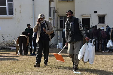
The waters may have receded in Medhipamua and over 500 villages of the country's most flood-prone Dhemaji district, bordering Arunachal Pradesh, but peoples' woes are far from over as the sand deposited by the mighty Brahmaputra and its tributaries pose a serious threat to their primary livelihood of paddy cultivation.
Agriculture is the mainstay of Assam's worst flood-hit district, which was once considered the 'rice bowl' of the state and its community, mostly comprising the Mising tribe though in some areas there is a mixed population of Hajong, Bodo and Sonowal tribes along with Nepalis who live in villages located along the river.
Over 100,000 people in the district were affected by three waves of flood this year which damaged croplands and washed away cattle, other livestock and houses. “We had earlier coped with the disaster in the hope that the alluvium silt left behind by the flood waters will lead to a bountiful harvest but now it is only sand that is deposited which has severely affected the cultivation of paddy crop,” a farmer of this village Khagendra Doley told PTI.
Sand deposition in the riverside villages, particularly in the paddy fields, is a long-term impact of flooding which increases with each rainfall in the catchment areas, bringing in more sand with no nutrients and less fertile silt, resulting in continuous land degradation, he said. Sand deposits have also increased over the years mostly due to rampant construction of roads, bridges, dams, and other development projects on the mountains of Arunachal Pradesh and along the river's path, experts pointed out.
“The abrupt drop of the slope of the River Brahmputra, plunging from an altitude of 3,000 metres in Tibet to less than 150 m at Pasighat after which it enters Assam, and its tributaries exert tremendous pressure in the immediate flood plains of the district,” Director of Rural Volunteer Centre, an organisation studying the impact of floods on local communities and providing interventions to the community, Luit Goswami, told PTI.
The flashy, unstable and unpredictable character of the 26 tributaries of the Brahmaputra that intersects through the district lead to massive flash floods, sand deposition, debris and river bank erosion, he pointed out. After the flood water recedes and the affected areas turn dry, it is found that the “sediment is mostly sand with damaged soil and the entire area turns into a desert”, he said.
According to the statistics of the Kisan Vikash Kendra (KVK), the total cultivable fallow land in the district is 12,490 hectares while the non-cultivable wasteland is 10,430 hectares with an additional 3,830 hectares of land with recent sand deposits which makes paddy cultivation a non-starter.
“Floods and sand deposits are the twin problems that have made cultivation very difficult and the area under paddy is coming down over the years. Earlier, under mono-cropping, we did winter, autumn, rabi and 'bao' rice but now autumn rice is not possible in most areas as the water recedes,” another farmer Arun Kardong said.
The Ahu (early variety), Bao (flood resilient) and Sali (winter) paddy are damaged due to massive inundation with crops washed away, followed by sand deposition which cripples the household economy, he said. Different agencies have tried to help regenerate the soil but it is a long-drawn process and has met with little success, he added. Goswami, however, points out that flood-affected communities of the district are very resilient and “if one door closes for them, they create other ways to survive. They are now shifting their attention to rabi and cash crops production”.
Mustard, potato, green peas, garlic, and french beans are some of the cash crops that have been taken up in the flood-affected villages as “these are less time consuming and we are getting the returns quickly”, another farmer Bhadra Doley said. The Bogibeel bridge, connecting Dhemaji and Dibrugarh, has brought in traders from Tinsukia, Dibrugarh, Jorhat and Nagaland who collect the produce from the farmers directly from the villages, he said.
“Problems are, however, there in the cultivation of these crops, too, as rainfall is erratic. We face heavy rains and floods for nearly six months of the year but now we are facing a drought-like situation with no rainfall for the last two months,” he said. The farmers have urged the authorities to provide proper irrigation facilities which are significantly lacking in the district. A resilient community, thus, battles on with the forces of nature and the consequences of climate change due to developmental works.


