Probably the British were running out of choices in naming forts in India and in a fit renamed the 18th century Gorkha fort of Pithoragarh as London Fort, we concluded when nobody was able to tell us why it was named thus.
The fort was located on the outskirts of Pithoragarh town. We went past the busy marketplace, the hub of the town, to reach the base of a hillock from where a short climb led us to the sprawling fort. The fort precinct housed government offices and it seemed additions and alterations had been made to the original structure.
According to media reports from last year, the fort, which is now popularly called the Pithoragarh Fort,is likely to be renamed as Sorgarh.
We had arrived in Pithoragarh the evening before, on our way to Munsiyari from Almora. Nestling in the middle of pine forests and overlooked by the Himalayan snow peaks, Pithoragarh in Uttarakhand is a fairly busy transport hub and a stop on the Kailash-Mansarovar pilgrim route. The headquarters of the eponymous district, it is about 30km west of the India-Nepal border across Jhulaghat. The Tibetan highlands lie to its north.
According to records, it was a flourishing city under the Chand rulers. Apparently, it was the tranquillity and the verdant landscape which earned it the name of ‘little Kashmir’. However, this pocket sized town and its surrounding can stand on their own is what we discovered. Escape to the outskirts and there is nothing to stop you from enjoying nature at her best – photo-worthy snow peaks, pine forests for short walks, crisp mountain air loaded with pure oxygen and a tranquil setting to quieten your frazzled urban mind.It is only during the festivals celebrated by the several temples in and around the town that the place sees a steady stream of visitors.
One of the popular temples, Nakuleshwar, is located about 10km from town, at a place called Athgaon Shilling. According to legends, this temple was built by the Pandava brothers Nakul and Sahdev.
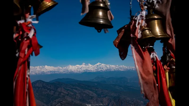
Another day we drove up to the base of the Chandak hill (about eight km from town). An uphill trek of about a kilometre will took us to the upper reaches. Although it was a tad cloudy and we could only make out the snow peaks briefly, on a clear day, you can catch a panoramic view of the town, the Soar Valley and some of the snow peaks standing tall among the flowing ranges, we were told. Reently, the place is being developed as a centre for hand gliding by the state tourism department.
About 55km from Pithoragarh is the Askot Wildlife Sanctuary, which was apparently established as a conservation centre for the endangered musk deer. Once ruled by the Katyuri dynasty, the place derives its name from the ‘Asi Kot’ or the 80 forts that were once built here; only a few scattered ruins survive. According to the tourism department, the sanctuary is also home to snow leopards, Himalayan black bear, snow cocks, bharals, pheasants, chukor, etc. There are also waterfalls inside the forest.
And if you are looking for an even more remote location, hole up in Dharchula, known for its mountain views, rivers and forests, and about three hours’ drive from Pithoragarh town. There are a few simple but comfortable guest houses here, great for sampling Kumaoni home cooked meals.
Getting there: Pithoragarh is about 151km by road from the nearest railway station Tanakpur. It is connected by bus with Delhi. Best to combine Pithoragarh with a trip to Munsiyari and Champawat. KMVN operates tourist rest houses in Pithoragarh and Dharchula.


