Fast facts
State: Uttarakhand
Location: In the Garwahal region, close to the border with Himachal Pradesh
Distance: 295 km NE of Delhi
When to go: March to June, October to early December. Winter temperatures drop to 2oC
Tourist Office: GMVN, 102, Indraprakash Building, 21 Barakhamba Road, New Delhi
Tel: 011-23350481, 23326620; gmvnl.com

Getting there
Air: Nearest airport: Dehradun (122 km/4 hrs).
Rail: Nearest railhead: Dehradun (92 km/3 hrs)
Road: Route from Delhi From Delhi and Dehradun, reach Kalsi via Herbertpur and Vikasnagar, crossing the Yamuna into Kalsi village and then on to Chakrata via Sahiya. From Mussoorie, head to Kempty Falls (12 km) and then on to Yamuna Pul (17 km); 4 km later, turn right to Lakhwar and drive on to Naghat, 11 km away. Chakrata is 30 km from here. The climb to Chakrata from Yamuna Pul takes 1.5 hrs
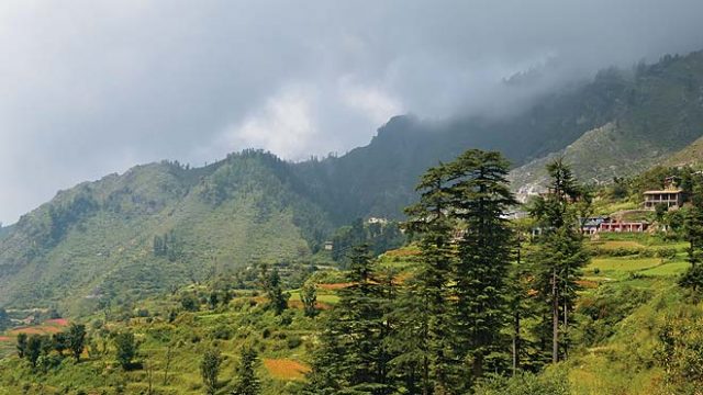
Chakrata is stunningly beautiful, a veritable treasure of abundant conifers, red rhododendrons and tall oak trees, interspersed with views of the snow-capped Himalayas and patches of dazzling blue skies. Therefore, visitors may wonder why hoteliers haven’t built swanky resorts here, where the ‘Mall Road’ is, and why, in general, the place is so ‘under-developed’. The reason this place is so quiet is that it is an access-restricted cantonment of the Indian Army, and the permanent garrison of the elite Special Frontier Force.
Things to see and do
Besides the views from nearly every vantage point here, there is literally nothing to do in this small one-horse town. So if your idea of the perfect break from the city is to do nothing except take rambling walks on quiet paths, snooze under the gentle sun or curl up with a book and a large pot of tea, Chakrata awaits. However, if you still feel the urge to be up and about, there are several tourist sights around Chakrata which are well worth a visit, and the town itself offers several little lanes for a pleasant amble.
As you enter Chakrata, you’ll come across a small central chowk, from where the road forks into two. The road heading straight is Tyuni Road, while the road to the right connects to the Mussoorie-Yamunotri Highway. On the Mussoorie Road, just a few minutes away, a road breaks to the right, taking you to the local market. Further down the Mussoorie Road is Chirmari Sunset Point, which offers simply spectacular views of the valley. As far as the eye can see, the vast valley plunges down, its verdant slopes covered by trees. In front, stretching into the distance, are the mighty Himalayas, their peaks enveloped by misty clouds. And the sunsets from here are, of course, unforgettable.
Note that only Indian nationals are allowed to enter Chakrata.
Where to stay and eat
A little further down this road, is Hotel Snow View (Tel: 01360-272241, 272481, Tariff: INR 950-1,800; www.chakratasnowview.com). Built in 1836, it is run by the sixth generation of the same family. Only a small part of the original building still remains. The rooms are large though basic.
The beautifully located Blue Canvas (Dehradun Tel: 0135-2666950; Tariff: INR 2,950 per tent, inclusive of food and activities; roadlesstravelled.in/bluecanvas) is a great choice. They offer comfortable tents with attached loos. There’s foosball, a pool table and even an improvised shooting range.
Outside town, 20 km away at Viraatkhai, the Himalayan Eco Lodges (Gurgaon Tel: 0124-4081500; Tariff: INR 1,000-2,300; www.himalayanecolodges.com) offer comfortable Swiss tents and lots of adventure activities.
Around Chakrata
Tiger Falls (5 km)
One of the most popular attractions near Chakrata, this waterfall splashes into a rocky pool from a height of over 300 m. You will have to park where the road ends and then it is an easy trek of about 1.5 km to the falls.
Deoban (13 km)
Drive approximately 5 km down Tyuni Road, from where the road leading right heads to Deoban. This picturesque meadow, at a height of 9,400 ft, is set amid a deodar forest. Spectacular views of the Himalayas, clear blue skies and ample opportunities for bird-watching draws visitors here, but it is rarely crowded. The road is not meant for a car with low ground clearance, so it is best to get a sturdy 4WD.

Budher Caves and Meadows (22 km)
These gorgeous alpine meadows and the mysterious Budher Caves lie 22 km northwest of Chakrata. Take the Tyuni Road till Lokhandi, then turn left, and then right. Approximately 3 km down this road is the Budher Forest Rest House. From here, a slightly narrow unpaved path is the beginning of a trek into a forest. The path goes by the side of craggy straight mountains, a sight quite unusual for Uttarakhand, where most mountains slope. Through deodar and pine forests, you’ll walk for about 2.5 km while thousands of brilliantly hued butterflies flit by. But even this path, stunning as it is, doesn’t quite prepare you for the utterly awe-inspiring vistas that await. The path unexpectedly ends, and rolling green meadows spread out ahead. It seems as if you’re in the plains, but the elevation here is actually 2,800 m.
Cross the first meadow, and to the left, the carpet of green stretches endlessly. It is a scene out of an Enid Blyton book: green meadows dotted with tiny flowers, a crystal-clear pond full with shimmering water, and herds of cows, sheep, and even a group of feral horses.
Ahead lie the Budher Caves. Be warned that it is extremely dangerous to venture inside without an expert local guide. It is said that despite several attempts to reach the end, no one has ever managed to do so. A German who discovered the caves in the 19th century made several forays into the structures and, apparently, ultimately died while exploring them.


