The Lamkhaga Pass, which connects northeastern Garhwal to Kinnaur in Himachal Pradesh, is surrounded by a tantalising landscape of snow and mountains, and an air of mystery. The long and, at times, treacherous trek to the pass involves steep ascents over scree and ice, and precarious crossings of glaciers and streams. The trail gains over 8,000ft in the space of a few days — from Harsil at 9,000ft to 17,335ft at the pass. The rewards, though, are many — lush green valleys, stunning vistas of towering peaks and lakes, glaciers and enormous fields of snow.
We started out from Delhi for Kuflon Basics, a fishing camp 30min ahead of Uttarkashi, where, after an 11-hour drive, we were greeted with piping hot food and cosy tents in the chilly environs of what was to become our home for the days to come.
In Uttarkashi, obtaining the elusive Inner Line Permit required to traverse the route was a somewhat tortuous process, but we made it to the Char Dham camp, 70km ahead at Dharali, in good time.
Hitting the trail from Harsil, the route to Lamkhaga begins with a steep climb on the very first day, with unconditioned legs begging for mercy. A great consolation, however, is the panoramic view all around as one goes higher into the mountains. We had our fair share of difficulties too — with hiking shoes coming apart, a nightly dose of the early monsoon, altitude sickness, lethal quantities of snow, and yours truly literally slipping off the pass itself. Appropriate equipment, courage and perseverance are a must for undertaking anything at an altitude of 17,300ft, as we found out!
The pass itself presents a 360o view of the majestic peaks serenading the Lamkhaga glacier. The waters from the glacier on the eastern side of the ridge flow into the Bay of Bengal, and those from the western side into the Arabian Sea. A swollen Baspa and its tributaries put paid to our itinerary and we lost two days getting to Dumti, where we were stocked with rations by the ever-hospitable Indo-Tibetan Border Police (ITBP) and informed that, fearing us lost, rescue parties had been sent out!
Finally, having covered about 85km in the most demanding terrain we had ever encountered, we reached the road head at Chitkul and laid the spirit of Lamkhaga to rest.
We finally set our eyes upon the elusive Lamkhaga Pass on day seven of the trek. After a trudge of about four hours, we found ourselves in the middle of an endless sea of snow. We were just below the pass, and the snow had started merging into the clouds. The only way to move forward without getting lost was to step into the footprint created by the person ahead. At two in the afternoon we set up camp at 16,000ft, an hour and a half short of the pass. It was the coldest, wettest night of the trek.
We were supposed to have camped in the meadow at Gagnan on the third day, but rain forced us to halt earlier. A half-hour walk on day four brought us to this meadow carpeted with spinach-like vegetation. Our destination was Kyarkoti, an arduous 15km trek away. At 12,220ft, we were well above the treeline, and the first symptoms of altitude sickness were showing.
We traversed the stunning and unforgiving terrain of the Lamkhaga glacier on day five. It took hours to walk the endless stretches of moraine and scree which had us tripping, falling and wondering how the porters could cope so easily. At 13,125ft, we were surrounded by pools formed by melting ice. The only dry brown patch we found turned out to be quicksand, so we camped on snow. Bottom (left to right): the climb was steep and the going slow; our first camp on snow; climbing a steep gradient towards ‘pass ke neeche’ on day seven.
The final few steps to the Lamkhaga Pass! On day eight, we set out at 7.45am. The next 40 minutes was a challenging, technical climb. Every time one of us stepped on a rock or boulder that seemed safe, it would let us down, threatening to throw us off the mountain. Finally, at 8.30am, we were standing on the ridge called the Lamkhaga Pass. It was a moment of pride, exhilaration and relief. From the pass we had a 360o view of various unnamed peaks, each more majestic than the other.
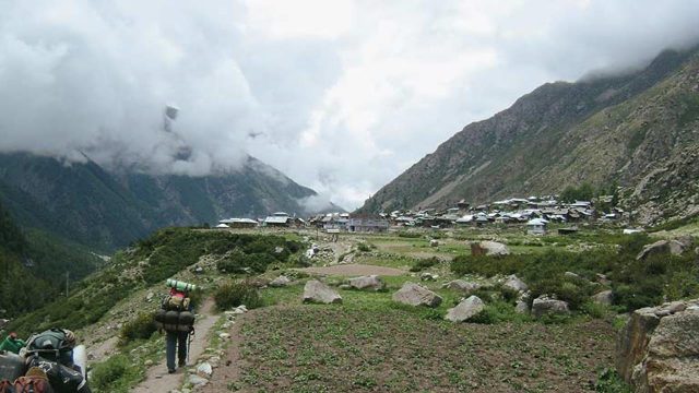
The quaint village of Chitkul in the Baspa valley of Himachal Pradesh is where the trail comes to an end. It is the first civilian settlement on this route between Uttarakhand and Himachal Pradesh. From here, the large settlement at Sangla is 26km and a short drive away. We’d been on the trail for 12 days, having been delayed by two days due to swollen rivers and unfordable streams. We’d seen some incredible sights, but we were now thrilled to see other human beings.


