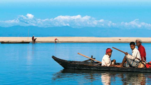
The massive river systems originating from the Tibetan Plateau have a huge impact on the northeastern states of India. Although there are numerous rivers that are integral to the socio-cultural ethos of this region, the Brahmaputra is arguably the most important, owing to its role as the great integrator of all the water bodies in the Northeast. The Brahmaputra originates from Chemayung Dung Glacier near the sacred Mount Kailash and the Manasarovar. Known in this region as Yarlung Tsangpo, it is the highest major river in the world. Springing forth from its source, the Tsangpo flows eastwards through southern Tibet, draining into the south Tibet Valley. While in the valley, the river flows from 4,500m above sea level to 3,000m.

As the Yarlung Tsangpo reaches the end of the Tibetan Plateau, flowing at a height of 2,400m, it takes a spectacular U-turn around Mount Namcha Barwa and thunders down through the Himalayan range with astounding velocity. At this point of time, the river carves a sheer gorge through the mighty Himalayas. Known as the Yarlung Tsangpo Grand Canyon, it has an average depth of about 5,000m around Mount Namcha Barwa. The Yarlung Tsangpo gorge here is defined by superlatives. Carved into granite bedrock, it reaches more than 5,300m from top to bottom in some places, making it three times deeper than the Grand Canyon. It’s also one of the world’s longest canyons, stretching more than 500km (300 miles).
The majestic river then cascades recklessly southwards, passing through the steep coun-tryside of Arunachal Pradesh, till at last it emerges from the foothills, considerably placated, and enters the state of Assam at Sadiya (135m above sea level).
Near Sadiya the river is called the Dihang and absorbs the waters of two major tributaries – the Luhit from the east and the Dibang from the northeast. Below this particular confluence, the river adopts its conventional name, the Brahmaputra, and then flows for a further 724km down the valley of Assam, broken by numerous islands.
At Saraighat, in Guwahati, the river is at its narrowest, measuring one kilometre from bank to bank. It was here that the historical Battle of Saraighat was fought in 1671 between the Ahoms and the Mughals and nearly three centuries later in 1962, on this very spot, the first rail-cum-road bridge over the Brahmaputra was opened to traffic.

After draining through the breadth of Assam, the Brahmaputra curves to the south, enters Bangladesh and continues on this course for about 240km until its confluence with the River Ganga. Within Bangladesh, the river varies considerably in width ranging from less than 2km to more than 12km. Further downstream the two rivers meet the Meghna and come to be known as the Padma. Not only are these individual rivers vast, each also has tributaries that are important by themselves in social, economic and political terms, as well as for water availability and usage.
In neighbouring Bangladesh, the Brahmaputra becomes truly gigantic. As the land flattens out, the river languishes, flowing lethargically, weighed down by the enormous load of silt. Eventually the silt settles, giving rise to innumerable little islands. Over thousands of years, these islands have come to be covered with mangrove forests where life has evolved in its own unique way. These are the Sunderbans, the largest single block of tidal halophytic mangrove forest in the world. For miles on end, lofty treetops form an unbroken canopy, while nearer the ground, signs of high and low tides are marked on the soil and tree trunks are clearly visible.
The many varieties of the natural mangrove forest have much to offer an inquisitive visitor. Here land and water meet in many novel ways and wildlife presents quite a spectacle.
The Teesta flows through the length of the state of Sikkim and is practically the lifeline of the Sikkimese people. After originating in the Himalayas, the river flows through Sikkim and West Bengal before entering Bangladesh and joining the Brahmaputra to merge into the Bay of Bengal. The river runs for an astounding distance of 393km and provides livelihoods to people staying along its entire length. The Barak river originates in the hills of Manipur; hill streams give the river its body. This river flows through Manipur and then enters Mizoram, from where it veers north to enter Assam. Here it enters the plains at Silchar before turning westward and entering Bangladesh.

The Kaladan river in Mizoram forms the international border between India and Myanmar. It is a lesser-known fact that it is the fifth largest river in the world to remain completely unfragmented by dams anywhere in its catchment area. However, a Transit Project is being worked on to facilitate trade relations between the two countries. The project aims to open up the northeastern states to the rest of the world by providing another access route to them, apart from via the Siliguri corridor in West Bengal.
Originating from the Laisang peak in Nagaland, Dhansiri is the main river of the Dimapur District. It flows for about 352km from south to north, with a catchment area of about 1,220sq km, before joining the Brahmaputra.


