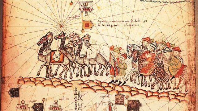
It’s a picture that speaks a thousand words. Back in the fag end of the fourteenth century, Marco Polo’s tales of his travels to China and other parts of Asia had electrified all of Europe. Overland trade with India and China was nothing new, but with the Arabs pretty much controlling the sea trade with Asia, the need for good, detailed maps became a priority. And a happy mingling of Muslim, Jewish and Christian minds gave birth to modern cartography as we know it.
The island of Majorca had prospered greatly from sea trade, and while under Islamic rule till 1231, reached its height of prosperity. While the Muslim traders provided knowledge of far off lands, the Jews who were the main men of letters, put them down in surprisingly detailed astronomical charts and trading maps. Such was the prowess of the cartographers of the island that when John I of Aragon wanted maps made, he turned to his vassals, the Majorcans. The latter excelled, bringing out vividly illustrated and coloured maps of Asia, Europe and northern Africa showing all the major trade routes, along with little snippets about Mecca — “In this town is the shrine of Mohammed the Prophet of the Saracens, who come here on pilgrimages from every country” — illustrations of Noah’s Ark near Jerusalem, the king of Ethiopia sitting on a goldmine, the Red Sea painted a vivid red, and, as in this picture, traders travelling to Asia in Marco Polo’s footsteps. This particular map was made by the famous Majorcan cartographer Abraham Cresques for Charles V of France.
However, Majorca’s fortunes were soon to slide, with both the Jews and the Muslims facing persecution and forced conversions first under the French and then the Spanish Inquisition. But the Majorcan cartographers with their open minds and professional brilliance anticipated the Renaissance.


