“If you don’t know where you are going, any road will get you there”—Lewis Carroll
How true. Here’s how I know…
Home for the holidays, after a short stay at my grandparents’ house in Manipur, in early January, my family and I were to head off to Arunachal Pradesh, after which I was to fly back to Delhi. We had a car, there were four of us, so we thought, what better way to do it than a road-trip? So off we went, from Jiribam in Manipur, and we drove down to Silchar in Assam, which was our night halt.
We had two options—NH 54, which covers about 493km from Silchar to Itanagar via Kalain, Shillong and Guwahati, or NH 54 and 52, longer at 627km, via the Dima Hasao district in Assam. We were told that the route via Kalain was in bad shape and it would be better if we braved the one hour of bad roads on the Dima Hasao route. Though the NH 54 & 52 was new to us, we were not too worried as we had done our research before hitting the road. Little did we know what we were in for.

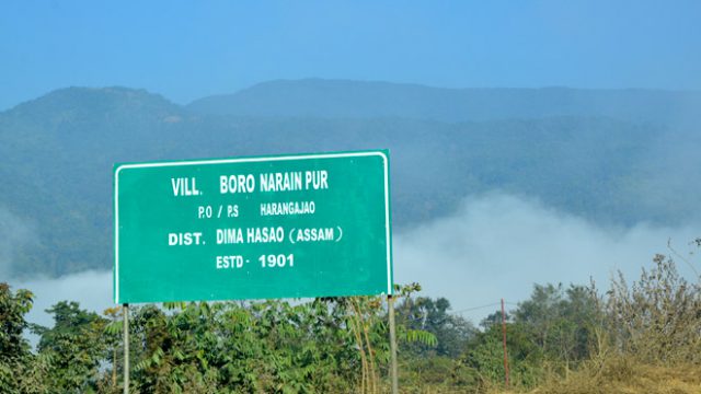
Soon after reaching Dima Hasao, we hit our first bad patch of road. Of course the scenery was breathtaking, but so were the jerks and bumps. We had to get off our tiny and overloaded Alto and walk for stretches, while it was driven to a smoother patch. This entire charade went on for good 20 minutes, until we reached Harangajao. Between Harangajao and Jatinga, we hit the worst patch—the road had turned into mud pools, and the car was in serious danger of skidding or busting the silencer pipes.
This road is a section of East-West Corridor Road, also known as the Mahasarak, connecting Saurashtra to Silchar. The ongoing work under National Highway Authority of India (NHAI) is progressing simultaneously with the conversion of old railway lines to broad gauge. With a little help from the off-season rains, and the hilly terrain of Dima Hasao, had created the perfect storm of non-existent roads and mud pools.

From Jatinga to Haflong was a trial and error session. At one point, we literally reached the end of the road! We’d missed a diversion. This happened quite often as quite a few of the many ‘Diversion’ signs had been washed away by the rains. Quite surreally, although we counted only six fellow humans on this stretch, we did come across dozens of signs that said ‘Sorry for the inconvenience’, ‘This road has been closed temporarily’ and more ‘Diversion’s in very fine print. For miles all we could see was a huge expanse of pulverised earth that spewed only dust (and despair). So what do you do when you reach a forked road with no signboards and people to help you? You take the route with most tyre tracks. We realised we weren’t lost when we heard JCB Excavators—we could finally ask for directions. We must have spent a good 4 hours trying to guess the correct route. Now our focus was to somehow reach Nagaon Bypass (NH 37) which meets NH 52 to Arunachal. I must say we took all the roads we possibly could to reach the bypass. 650km in 18 hours!
We finally reached Arunachal Pradesh very late into the night. It was 2010 when I had last visited my parents’ place of work in Hoz, and I remember riding jeeps over boulders just to get to our house. It was 2016, I couldn’t help but gawk at the gleaming new road, smooth as silk with not a single bump. I must say this compensated somewhat for the traumatic ride in Assam.
A small plea to the Government, for something like National Highways, delays on such works affect habitation and commuting on a very large scale. Making the place cell-phone network friendly would be nice. Or atleast put up big visible road/diversion indicators!


